Resource to Shapefile Wizard
Used to export a resource (often selected in the Catalog view) to a shapefile. This wizard is typically used to export contents from a remote WFS or Spatial database local storage.
The results of this wizard are added to the Catalog for your immediate use.
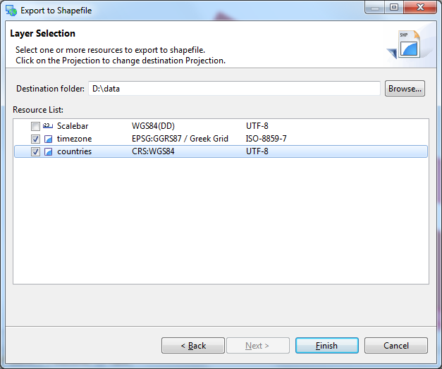
Please note that only feature content can be exported to a shapefile. In the above picture clouds.jpg cannot be selected as it is an image file.
Destination
The location to save the generated shapefile. The filename used will be will be based on the resource name.
Resource List
List of selected resources:
- Check: you may check off the resources you wish to export
- Name: Resource name, this will be used as the filename of the generated shapefile
- Projection: Shows the projection of the resource; you can change setting to transform the contents into the requested projection. The projection information will be stored in the resulting prj file.
- Charset: Shapefile charset encoding; you can control the encoding of string fields during export. The proposed value is controlled by the startup system property shp.encoding or if not specified by the preference value General–>udig UI–>Default Character Set
Related concepts